Preparing for the hike and tips along the way!
The Tongariro Crossing is one of the World’s Most Epic Day Hikes according to National Geographic. Located on the North Island just below Taupo, Tongariro is a National Park and Dual World Heritage site featuring out-of-this-world volcanoes, craters, mineral springs, vivid green and blue lakes and forests.
Though there are dozens of peaks, Tongariro, Ngauruhoe (Mt. Doom in Lord of the Rings) and Ruapehu are the stars. All three are active volcanoes, with Tongariro erupting as recent as 2012. The 12 mile and 765 meters elevation gain hike has the drama and rare scenic views that makes for a spectacular addition to any New Zealand itinerary.
Most hikers base themselves in the town of Taupo, about 1.5 hours north of the Tongariro trailhead. The visitor centers, hotels and hostels are accustomed to travelers opting for the day hike and offer recommendations and shuttle transportation to the mountain. Don’t get caught up in the warnings and intimidating preparation videos. If you can walk several miles, and spend 30 minutes on a stairmaster, you’ll be good to go.
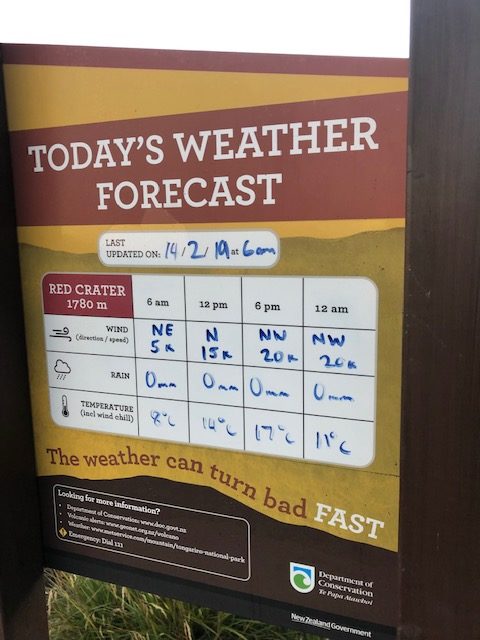
My friend and I stayed at the Haka Lodge for a couple of nights. The hostel’s team makes reservations for the shuttle 24 hours beforehand to confirm acceptable weather and lack of volcanic activity, which you can keep track of here. It is a one-way hike so the drop off and pick up points are different. Once the shuttle is reserved, there is no entrance fee or permit required.
Tip: The evening before, load up on provisions as there’s no opportunity to buy food the next day. I picked up a sandwich, fruit and snacks and an extra bottle of water. I left them in our hostel’s fridge and was surprised to see the kitchen buzzing at 5am that morning. Roughly 75% of the hostel was joining me on the hike. The popularity of this hike has risen and you’ll definitely experience congestion in the first couple hours of the trek. However, it thins out and I didn’t bump into more than 10 people the last 2 hours.
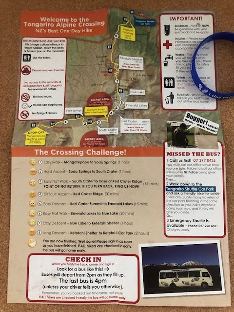
Most shuttles arrive in Taupo between 5:00AM and 6:00AM. Our hostel arranged a round-trip shuttle for $65 with Taupo Expeditions. Our bus arrived promptly at 5:30AM, and we were given an hour to sleep before the driver woke us up about 20 minutes prior to arriving. His rundown included tips and suggestions i.e. use the first public restroom as they get progressively worse throughout the hike and you must finish within 8 hours or risk losing your spot on the bus home. We were also given a map that is divided into 6 sections and levels of difficulty, as well as an “I did the crossing” bracelet for the bus ride home.
Tip: The Taupo Expeditions company also offers any last minute needs for rental purposes: hiking boots, rain jacket, cramp-ons during the winter, or socks, gloves and water to purchase.
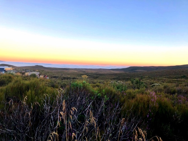
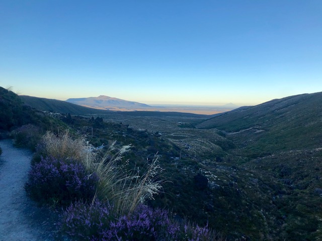
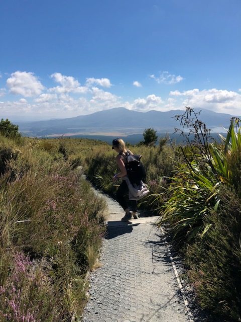
1. The sun was just starting to peak out as the driver bid us farewell and good luck! “Mangatepopo Car Park to Soda Springs” is estimated to be a one hour easy grade start. The trail begins at Mangatepopo Road and winds its way through grasslands and alpine foliage and along the Mangatepopo Stream. At one point there are some wetlands so the dirt path switches to a narrow boardwalk.
Soon enough the greenery turns to a barren landscape with lava rock, an ashy surface and views of the menacing Mt. Ngauruhoe. At the end of this flat section, the warning signs appear. “STOP. Are you really prepared to continue your Alpine crossing trek?” I paused to read it just as one woman shouted, “Don’t look, just keep going!”
2. The “Soda Springs to South Crater” part is accurately rated as difficult as it includes the Devil’s Staircase, a steep accent on mostly wooden stairs and layers of ancient and modern lava.

3. The “South Crater to Red Crater” is an easy 15 minute walk along a moonlike flat surface and a chance to catch your breath. Also considered the point of no return if your health or the weather declines.
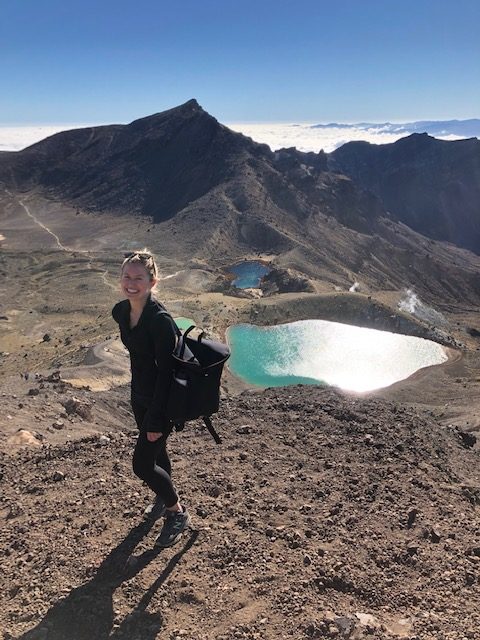
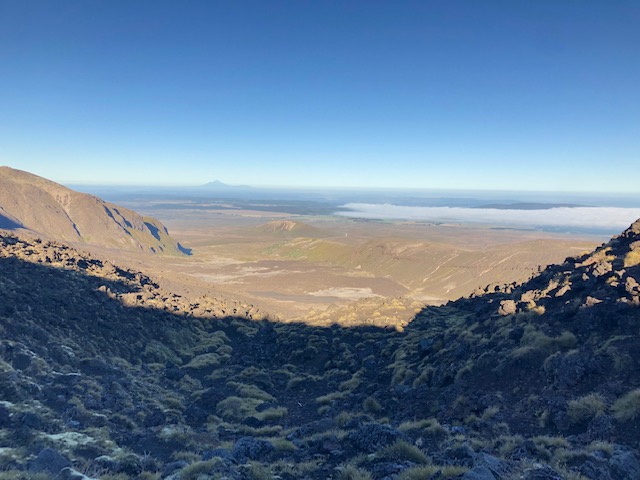
4. The “Red Crater Ridge” is the final and most difficult climb up to the summit. Though this is considered the halfway point, most of the hard work is done once you reach the top. You’re rewarded with a mind-blowing panorama: 360-degree views of Mt. Doom, the Red Crater and the Emerald Lakes, all above the clouds.


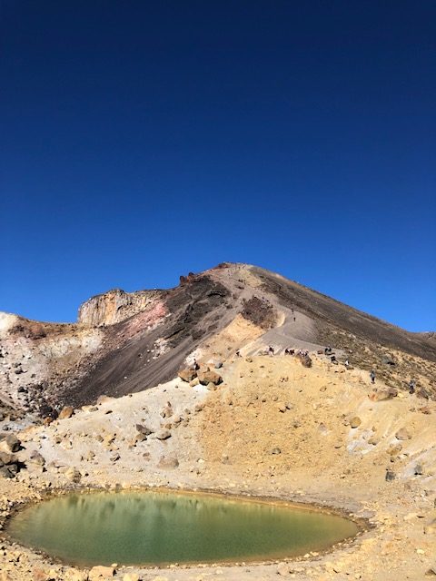
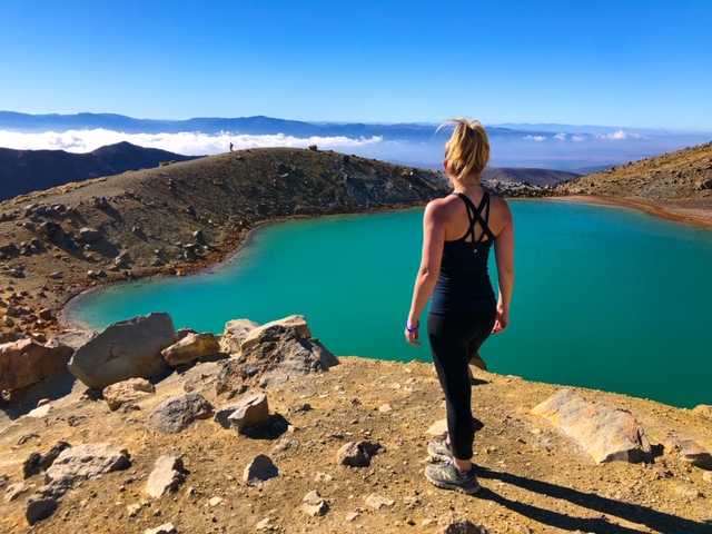
5. “Red Crater Summer to Emerald Lakes” is just 15 minutes and rated as an easy descent, though I actually found this to be the most challenging. It is a steep descent down made trickier with the loose scoria, or volcanic rock. I saw several techniques: running for it, sliding down on your butt and or doing the slow side step. Once down you can explore the aptly named Emerald Lakes.
4. The “Emerald Lake To Blue Lake” section should be a scenic spot for lunch, but the sulfur smell will have you holding off. The 20 minute easy track follows around the edge of Central Crater then a slight climb up to Blue Lake, considered the most sacred of all the other hallowed peaks and waterways.
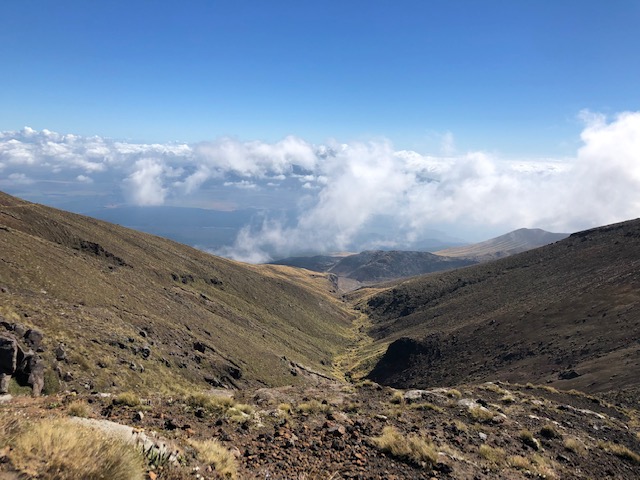

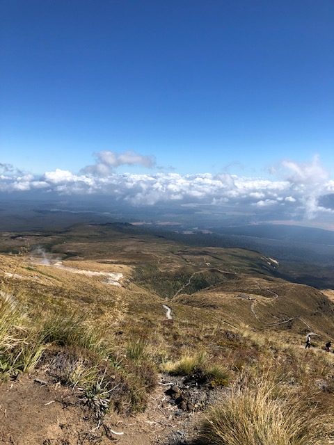
5. The “Blue Lake To Ketetahi Shelter” is approximately an hour and rated as a moderate grade. It’s a short easy climb to the edge of North Crater, which was filled with molten lava and then cooled and solidified to a level surface. Then the path follows the Rotopaunga Valley down the north side of Mount Tongariro with a series of large switchbacks. Views include the next landmark (Ketetehai Shelter), Lake Rotoaira and even across to Lake Taupo on a clear day. A bonus effect is the cool steam billowing from the hot springs in the area.
6. The alleged moderate two-hour “Ketetahi Shelter To Ketetahi Car Park” section begins with warning signs about entering an active volcano zone, suggesting that you shouldn’t dilly-dally in this area. Though this was cautioned to be a suspiciously difficult and tedious section, I enjoyed the lake views and forest setting. I would have gladly made the trek for this section alone. The Tongariro Crossing continued to be spellbinding all the way to Ketetahi car park.
Tip: 6-8 hours is the projected time to hike the Tongariro Crossing. I didn’t think I was moving quickly and my time clocked in at 5 hours 25 minutes, with several stops for photos and one 20-minute lunch break. The first bus doesn’t come around until hour 6 so it meant waiting around. Had I known this, I would have stopped for more photos and savored a longer break at the Ketetahi Shelter.
There was a mad dash for the buses once they arrived. We were divided up by bracelet color (based on accommodation locations) and then hit the road. I was back in Taupo at 3:00pm – plenty of time to nap, rest, explore and have a well-deserved dinner. Click here for my North Island itinerary, which features the Tongiriro Crossing.
Alternatives
Though it’s considered a landmark on the trail, you have to take a 15 minute side trip to view Soda Springs, which is a small waterfall located before the Devil’s Staircase.
There’s an unofficial option to summit Mt. Ngauruhoe after the Devil’s Staircase. The land is considered sacred so you won’t find anyone promoting the hike, but it can be done. It’s a 2.5 hour additional hike rated as difficult.
Tongariro Northern Circuit is a longer 3 day hike that winds its way around the Tongrariro National Park hitting all of the highlights.
For a quick summary:
- Stay in Taupo, the closest real town with other NZ activities
- Check the weather and book a shuttle to the Mangatepopo Road trailhead 24 hours before
- Buy provisions the night before: food and water
- The weather is unpredictable and even on a nice summer day, it can be very chilly and windy
- Wear layers, all-terrain traction sneakers or hiking boots, bring a waterproof jacket, extra socks, sunscreen and toilet paper. Some things can be rented from Tongariro Expedition the morning of
- Things to note: there is no wifi! There are 8 toilets located throughout the hike. There are no water dispensaries or trash cans – carry in/carry out policy. The lakes and peaks are considered sacred – don’t touch or otherwise risk angering the Māori spirits
- Bring a portable phone charger or your best camera
- Mentally prepare for 12 miles, two steep inclines and at least 6 hours on the trail
- Relish in a one of a kind real life-Mordor hike!